Official website links end with .gov.sg
A Singapore Government Agency Website


Secure websites use HTTPS


Rainfall prediction - enchancing PUB's response to flash floods
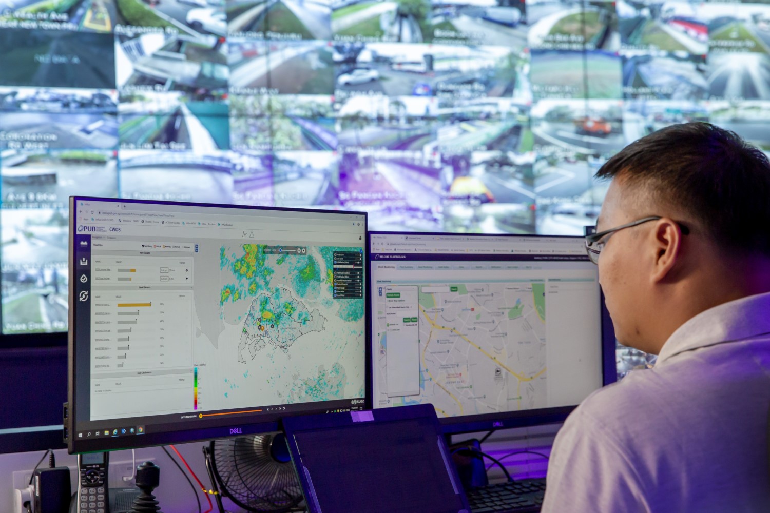
Water level sensors, CCTV cameras and rainfall maps - these are some of the equipment PUB relies on to monitor for flash floods during heavy rainfall events.
Now, officers on duty at the national water agency's Joint Operations Centre have a new tool at their disposal - a system capable of predicting the locations where heavy rain is expected, allowing them to deploy PUB's Quick Response Teams (QRT) early to where there could be potential flooding.
This augments the data that PUB currently receives from the Meteorological Service Singapore (MSS) for heavy rainfall alerts. MSS also provides two-hour weather forecasts for the various towns across Singapore.
The rainfall monitoring and prediction system will enhance PUB's response to flash floods, a key area where there is always room for improvement, says Senior Principal Engineer (Drainage Operations) Thomas Soh.
What we needed was localised forecasts so we can pinpoint with higher accuracy the specific areas that are likely to experience heavy rainfall. This will allow our QRT vehicles sufficient time to travel to locations with high flood risk in anticipation of any potential floods.
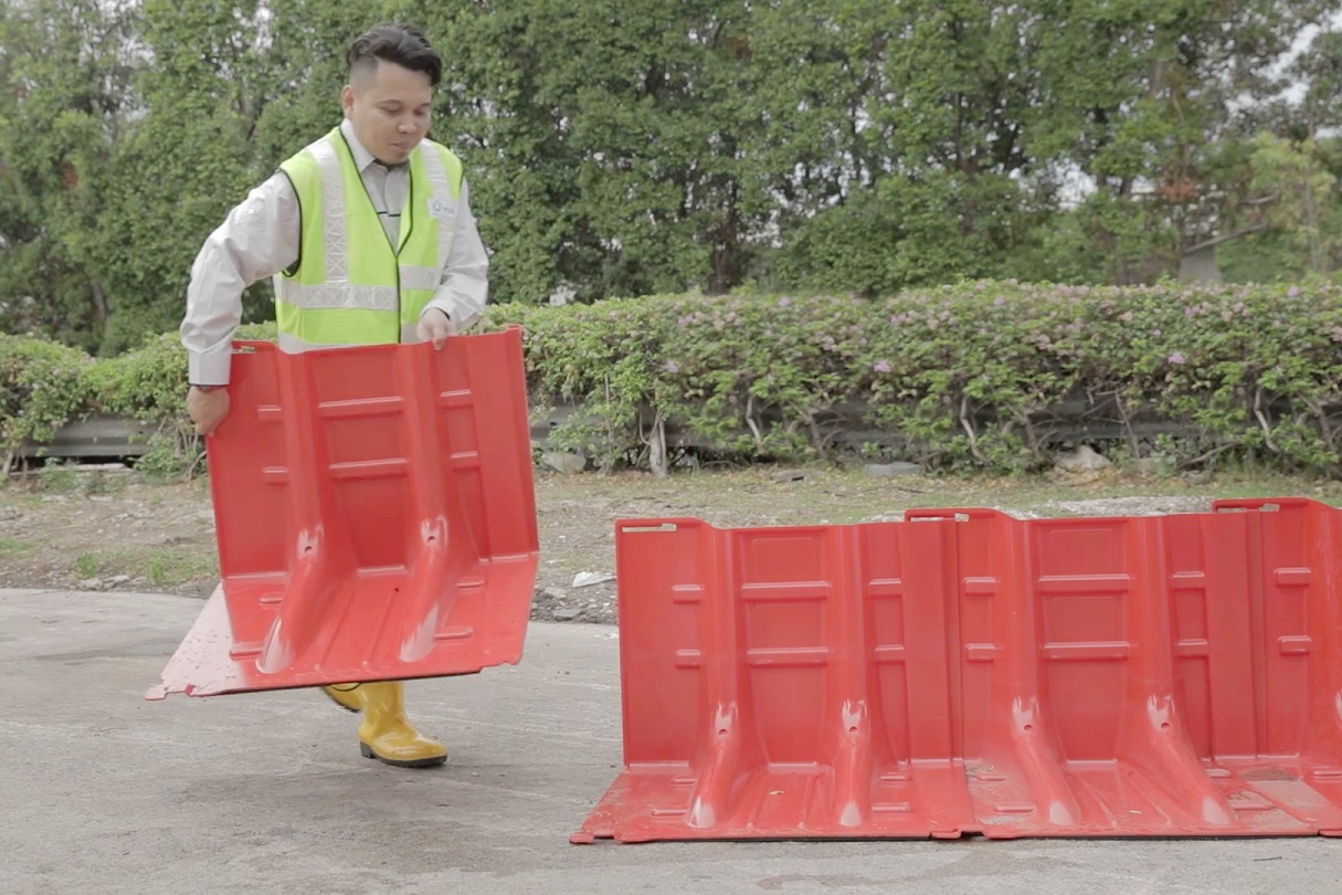
Should a flood occur at the location, our officers are already on site to render assistance such as traffic management, locate possible drainage choke points or if the flooding is particularly severe, deploy portable flood barriers to divert floodwaters and keep public out of harm's way.
Lightweight and self-anchoring, portable flood barriers can be quickly deployed to divert floodwaters from roads so that traffic remains passable.
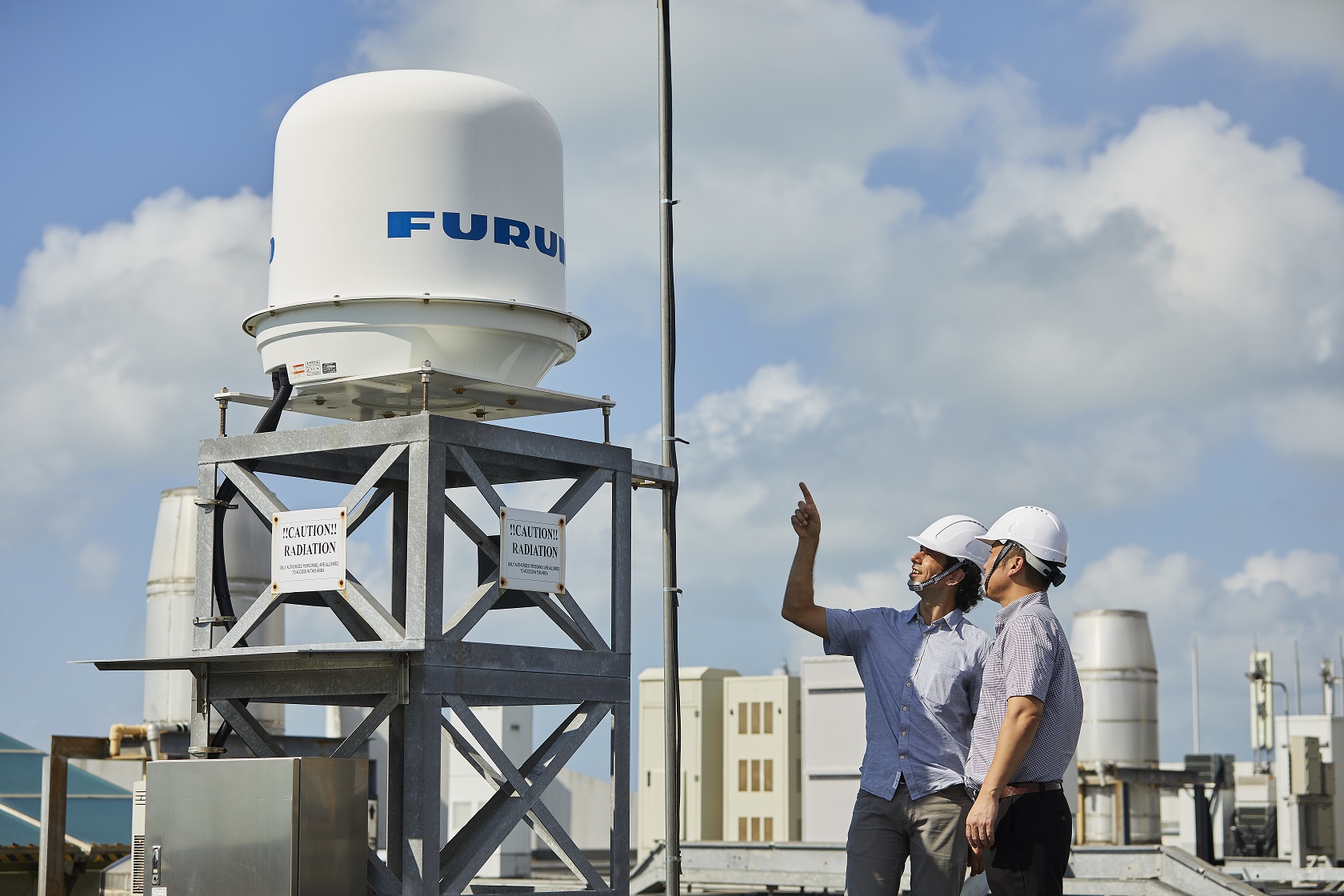
In 2016, PUB worked with Hydroinformatics Institute (H2i) Ptd Ltd and industrial electronics firm Furuno Singapore Pte Ltd to install three X-band radars - which are compact and suited for monitoring rainfall within short ranges of 30 to 50km - in the northern, eastern and western parts of Singapore.
Picture, shows X-band radar at Changi Water Reclamation Plant. The two other radars are located at the Woodlands NEWater Service Reservoir and CleanTech One building.
These radars, which are typically used for air traffic control and maritime vessel navigation, scan the sky for rain. The information is translated to a high resolution map of 100m x 100m grid cells showing the current rainfall intensity over Singapore.
The information is also fed to a rainfall nowcast model that generates accurate rain forecasts for the next 30 minutes. The model uses the observed movement of rain clouds and the change in rainfall intensity over time to produce these forecasts.
Currently, the system has an accuracy rate of 65%.
"The main challenge to improve the accuracy of the radars is the way rainfall develops in Singapore, or tropical climates in general. It is highly localised - for instance, it might rain heavily in one area but just a few kilometres away, there is no rain. Rainfall events are also normally very fleeting," says Dr Albert Goedbloed, H2i's senior consultant in charge of the project.
"Having a better understanding of the start of a rain event and its growth and decay is the key to improving forecast quality."
Aiming to enhance the system's accuracy and to allow for better coverage across Singapore, PUB will be installing three more X-band radars at various locations. Locations under consideration include Seletar, Tuas and central Singapore.
H2i will also be introducing a machine learning algorithm to the system to further increase its accuracy.